|
Home
Regions
Planning & Info
RVing Archeology
Articles
Road Logs Insurance Photos Mexico News Ontheroadin |

|
Becán Campeche Mexico by Bill and Dorothy Bell
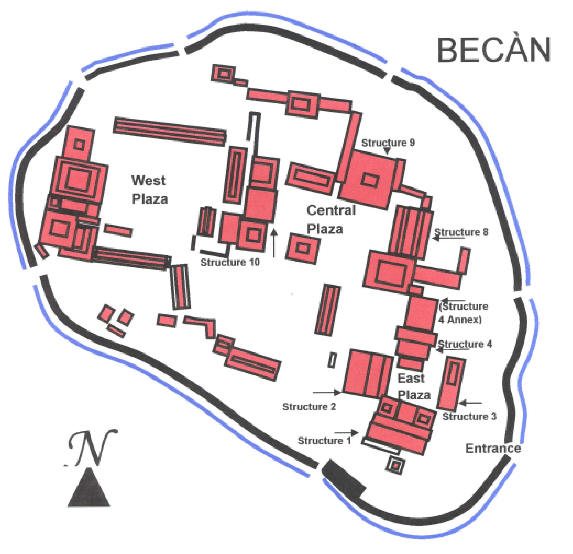
Click site map to enlarge
Becán is a one of the Major Archeological site (of at least 45) that graces the base of the Yucatan Peninsula. It is by and large, unknown by the core tourist crowd, and you can walk by yourself in the forest as you discover restored pyramids, grand plazas and temples and palaces.
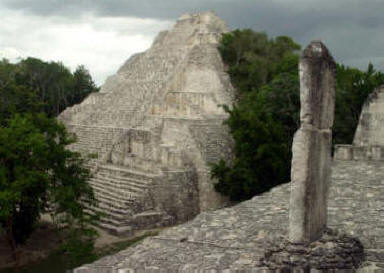
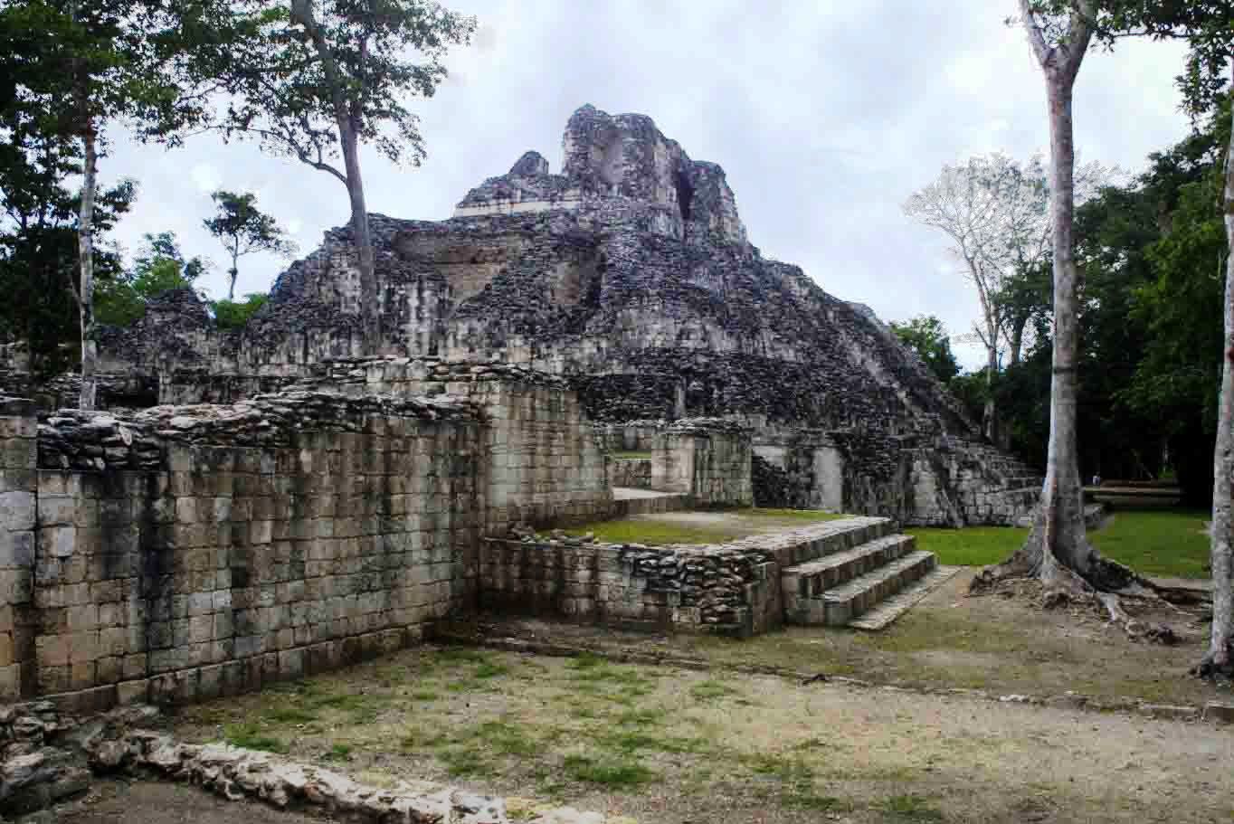
Twin Towers of the Rio Bec region
The fascinating moat, the only one as yet discovered in the Mayan world, was used as a fortification around the limestone structured City to head off potential problems with other trading and religious centers. Clay works and figurines from Teotihuacán provide links to trade and possible wars amongst Becán, Tikal and Teotihuacán.
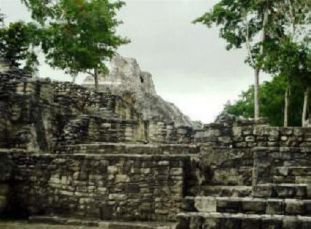
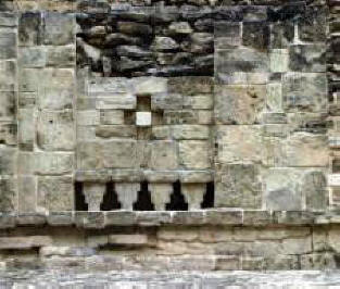
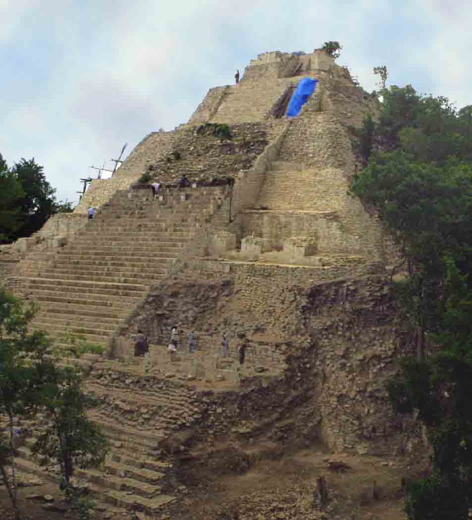
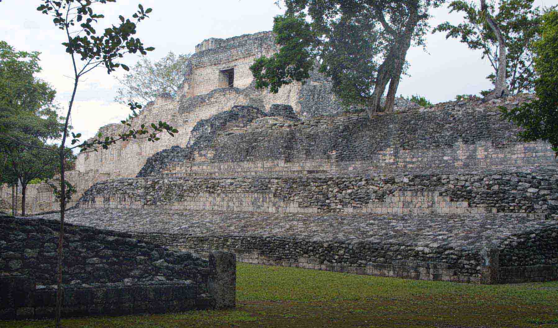
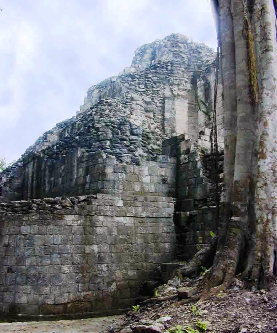
Detail and lattice work The Rio Bec style includes large platforms, two – sometimes three towers grace the large pyramids with a grass or palapa roof on the top. Often there are false stairways and misleading entrances. The City is characterized by large plazas surrounded by monumental structures indicating its importance in the region. Becán also shows signs of the Chenes influence with detailed masks of the Itzamna god, also called the Earth Monster. The highest structure is approximately 30 meters or100 feet high.
Inside the city is a maze of dirt roads leading from
one complex to another. Like many ancient cities, Becán has a small but well
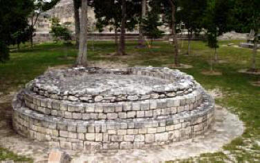
defined ball court. An unusual feature situated prominently in the main plaza is
a round pyramid dedicated to the God of Wind.
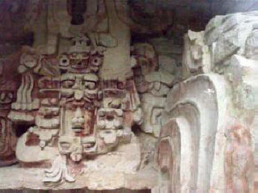
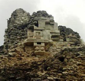
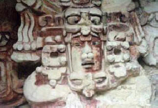
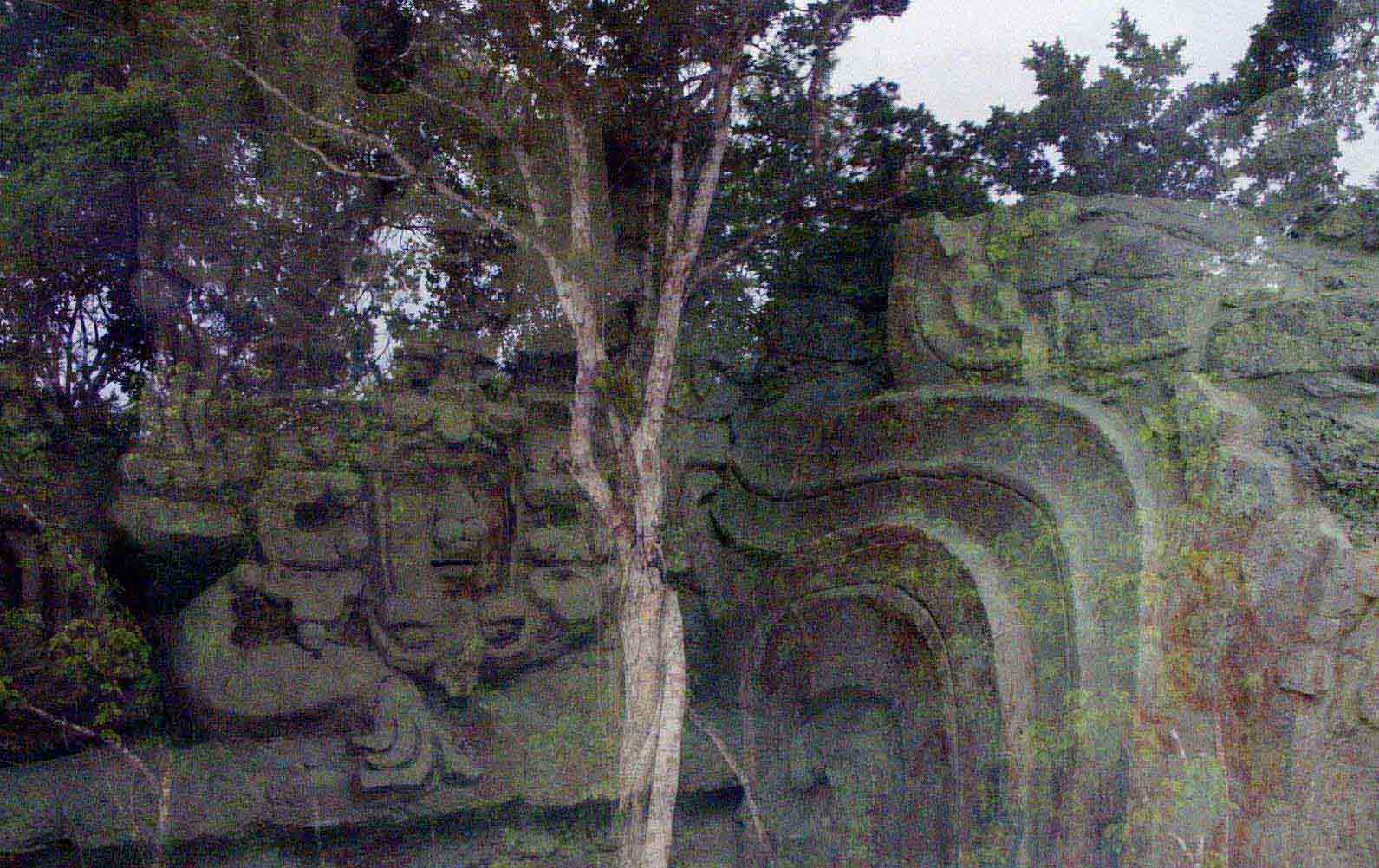
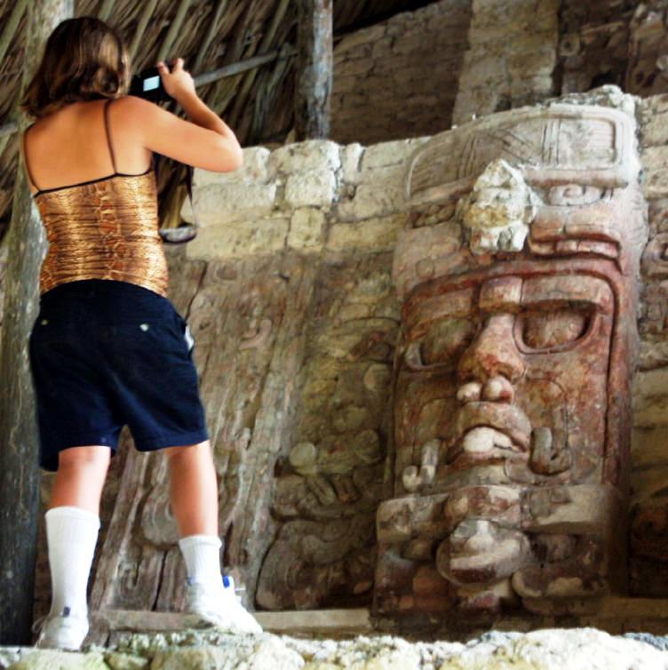
The best example of the “Monster” is on Temple X – whose mouth is the entrance doorway. A remarkable mask of the Sun God Kinichna is protected in a climate controlled room flanking that same pyramid. It is well preserved with very defined features and with its original paint.
You can stroll safely undisturbed throughout the site.
Sun God Kinichna
GPS - N 18*31.023 W 089*27.860 Double click on any of the following pictures
and map to view
in larger format
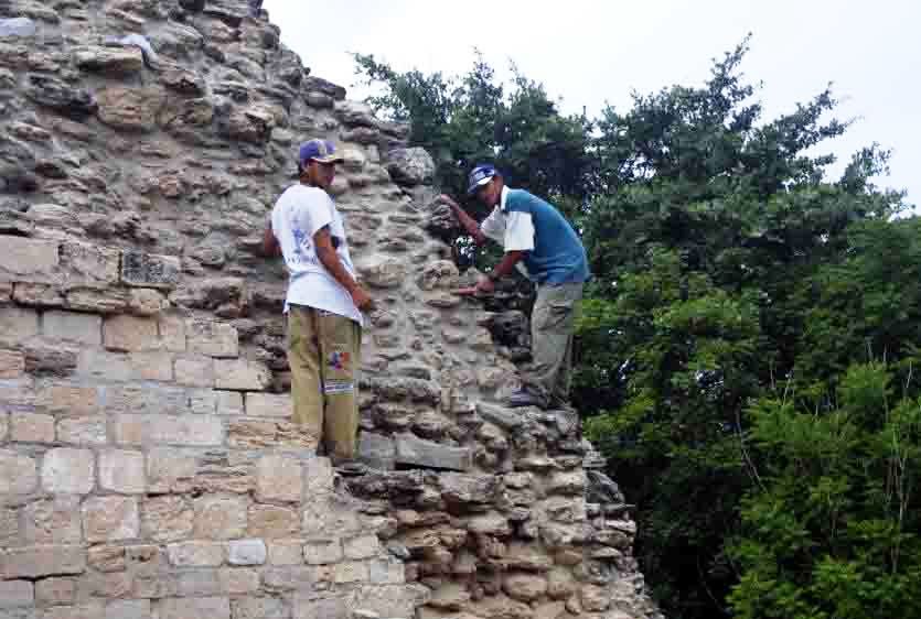
Restoring a structure in Becán
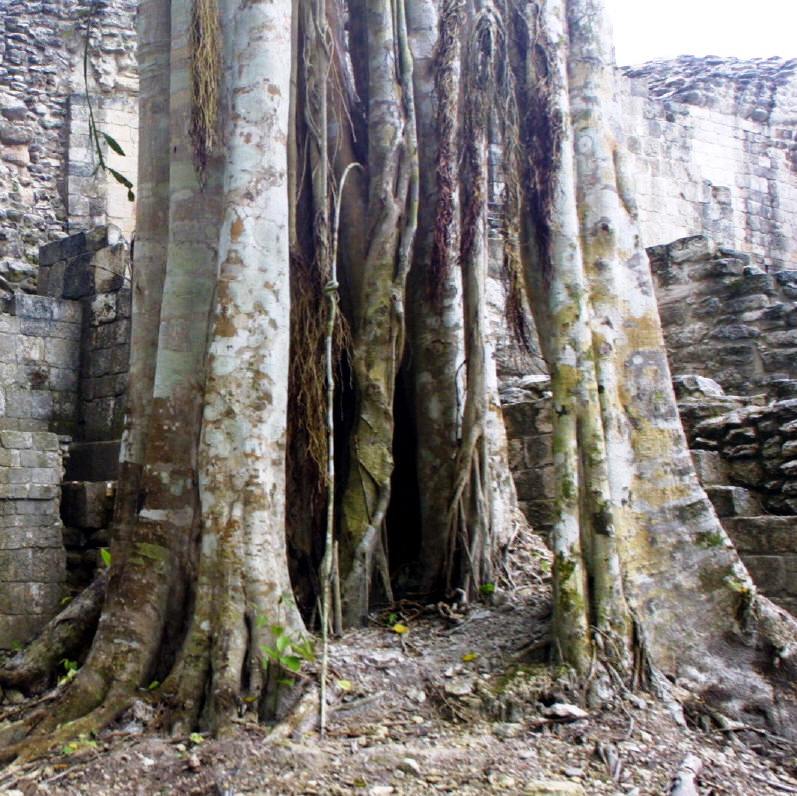
Trees are part of the attraction at Becán
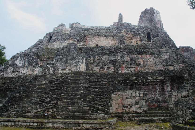
Structure lX Becán
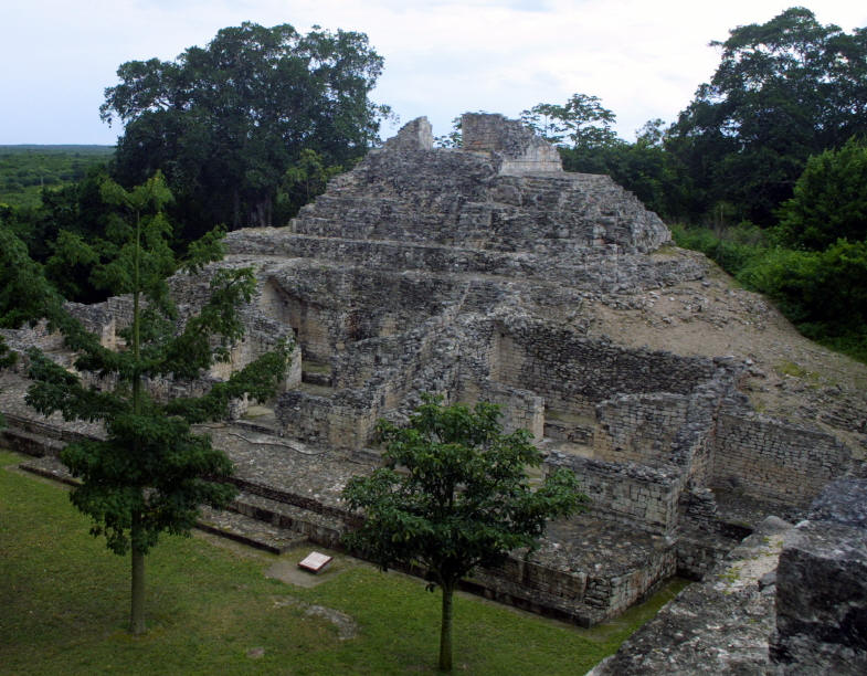
Plaza A
Workers restore one of the many structures at Becán
This carving was protected by glass but still holds its beauty
Other Rio Bec Mayan Sites Balam Ku, Chicanna
|
*
|
|
What You Should Consider for Your Visit
|
|


On the Road In - Mexico
editor@ontheroadin.com