Faces
of Mexico -
Nautla and Costa
Esmeralda by Bill and
Dorothy Bell
This was originally a
pre-Hispanic settlement inhabited by the Totonacs. The Indian name
Nauh-tlan nahua that means "Four Places" in
reference to four Indian settlements.
In the middle of the
16th century, Juan de Rio was granted the basin territories of this region. In
1680, Nautla was established as a town. It was the site of battles during the
insurgent uprising headed by Don Guadalupe in 1814.
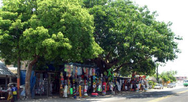
Nautla has a current
population of around 3,000 people and nearly 7,000 located close to the town. It
is a charming town with small zocalo established in the center, small shops and
restaurants. The area grows and abundance of tropical fruit and tobacco. It also
caters to Mexican tourists and the occasional RV that passes through on the way
to points south.
Highway 180, as it
makes it
 Driving
the Highway 180 down the Gulf Coast of Mexico in the Northern section of the
State of Veracruz, is a magnificent stretch of beach known as Costa Esmeralda or
Emerald Coast. This seaside community lies just to the north of the town of
Nautla and is only a 3 hour drive from the Capital City of Veracruz. The
vegetation is lush with mahogany, cedar and chicozapote. Citrus is everywhere.
Fresh pineapple, oranges and limes.
Driving
the Highway 180 down the Gulf Coast of Mexico in the Northern section of the
State of Veracruz, is a magnificent stretch of beach known as Costa Esmeralda or
Emerald Coast. This seaside community lies just to the north of the town of
Nautla and is only a 3 hour drive from the Capital City of Veracruz. The
vegetation is lush with mahogany, cedar and chicozapote. Citrus is everywhere.
Fresh pineapple, oranges and limes.
 In
1518, Juan de Grijalva crossed the Gulf from
Champotón and called the area New Alemaria. Cortez makes reference to
Nautla in a letter to the King of Spain. When the Spanish arrived, the Totonacs
fought with the Spanish to overpower Cuauhpopoca (a tax collector for
Moctezuma). The encounter took place between the Nautla and Misantla Rivers in
the first battle of Nautla. This was a pivotal event and led to the eventual
execution of Moctezuma, his sons and fifteen other nobles.
In
1518, Juan de Grijalva crossed the Gulf from
Champotón and called the area New Alemaria. Cortez makes reference to
Nautla in a letter to the King of Spain. When the Spanish arrived, the Totonacs
fought with the Spanish to overpower Cuauhpopoca (a tax collector for
Moctezuma). The encounter took place between the Nautla and Misantla Rivers in
the first battle of Nautla. This was a pivotal event and led to the eventual
execution of Moctezuma, his sons and fifteen other nobles. 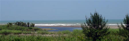
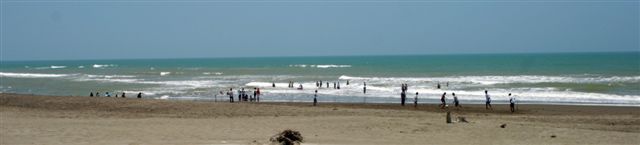
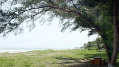
 Costa
Esmeralda has 35 kilometers of clean wide beaches and true to it's name, lush
intense green vegetation close to the rivers. The waves are friendly and the
swimming is fine. Clam waters invite fishers and swimmers alike. Lay back and
enjoy the easy lap of waves, a good book and the softer spring sunshine.
Costa
Esmeralda has 35 kilometers of clean wide beaches and true to it's name, lush
intense green vegetation close to the rivers. The waves are friendly and the
swimming is fine. Clam waters invite fishers and swimmers alike. Lay back and
enjoy the easy lap of waves, a good book and the softer spring sunshine.
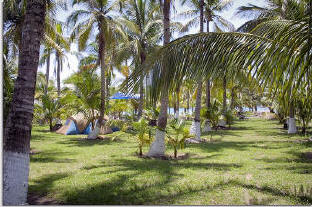
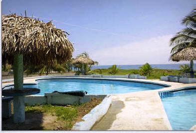
RV parks and simple tent camping is abundant. There are at least fourteen places to park your rig with the usually variety of cleanliness, services and facilities. Most have pools as well as being parked right on the Gulf waters.
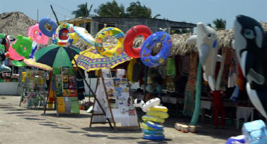
There are supplies for campers along this highway 180 strip; basic foods, fish, beer and ice. Enjoy local cuisine, undoubtedly fish, served fresh and cheaply at local restaurants. A stop well worthwhile and an opportunity to mix with Mexican campers.
Map Features:
North to South
RV
Parks![]()
