|

| |
Guanajuato, Guanajuato Mexico
Photography by Bill Bell
The Mexican city of Guanajuato is the
capital of the state of the same name. It is located at 21°02′N 101°28′W /
21.033°N 101.467°W / 21.033; -101.467, 370 km (230 miles) northwest of Mexico
City, at an elevation of 1,996 m (6,550 ft) abov e
sea level. The 2005 census population was 70,798 people in the city. Guanajuato
is also the surrounding municipality of which the city is municipal seat. The
municipality had a population of 153,364 and an areal extent of 996.74 km²
(384.84 sq mi). The city of Guanajuato lies near the western edge of the
municipality, which includes numerous smaller outlying communities, the largest
of which are Marfil, Yerbabuena, and Santa Teresa. Guanajuato, although it is
the state capital, is only the fifth-largest city in the state, behind León,
Irapuato, Celaya, and Salamanca. The historic town and adjacent mines are a
World Heritage Site. e
sea level. The 2005 census population was 70,798 people in the city. Guanajuato
is also the surrounding municipality of which the city is municipal seat. The
municipality had a population of 153,364 and an areal extent of 996.74 km²
(384.84 sq mi). The city of Guanajuato lies near the western edge of the
municipality, which includes numerous smaller outlying communities, the largest
of which are Marfil, Yerbabuena, and Santa Teresa. Guanajuato, although it is
the state capital, is only the fifth-largest city in the state, behind León,
Irapuato, Celaya, and Salamanca. The historic town and adjacent mines are a
World Heritage Site.
History
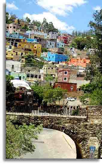
Guanajuato was founded as a town in 1554 and received the designation as a city
in 1741. It is located in one of the richest silver mining areas of Mexico, and
is well known for its wealth of fine colonial era Spanish architecture.
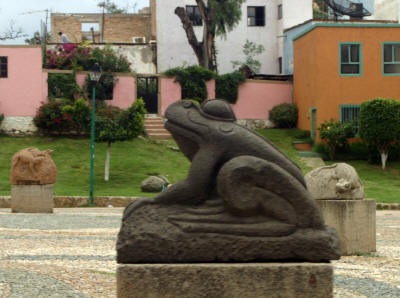
The Spanish name "Guanajuato" comes from Quanaxhuato (or Kuanasiutu in a
different orthography), meaning "Hill of Frogs" in the local indigenous
P'urhépecha language (a large rock formation outside of the city of Guanajuato
looks remarkably like a frog, and frogs are common in the region).[1][2] In the
native religion of the P'urhépecha (Tarascans), the frog represented the god of
wisdom.
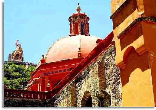
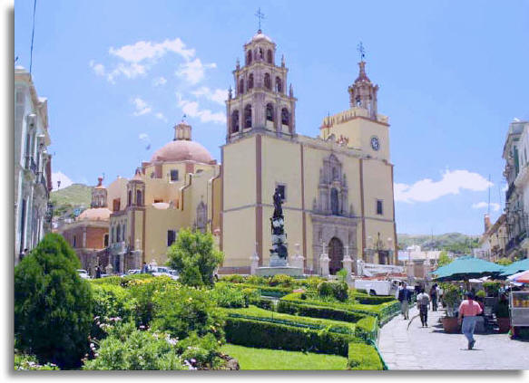
Plaza de la Paz and the Basílica Colegiata de Nuestra Señora de Guanajuato
(2004)The city was originally built over the Guanajuato River, which flowed
through tunnels underneath the city. However, after years of raising buildings
to accommodate repeated flooding, in the mid-twentieth century, engineers built
a dam and redirected the river into underground caverns. The tunnels were lit
and paved with cobblestones for automobile traffic, and this underground road network
carries the majority of cars driving through the city today. It is one of the
most notable features of the city.
with cobblestones for automobile traffic, and this underground road network
carries the majority of cars driving through the city today. It is one of the
most notable features of the city.
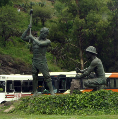
The city played a major role in the Mexican War of Independence since it is the
capital of the state of Guanajuato in which Miguel Hidalgo started the
independence movement. The statue of El Pípila and the Alhóndiga de Granaditas
still remind of that time.
Attractions
Cristo Rey del CubileteCristo Rey del Cubilete (Christ the King Shrine) is one
of Mexico's most important religious monuments, and is said to mark the
geographic center of Mexico.[3] The 65-foot statue atop Cerro del Cubilete is
the destination of an annual cabalgata (pilgrimage) every January to celebrate
the Epiphany, in which thousands of pilgrims, mostly on horseback, ride to the
shrine.
Hand of Guanajuato Mummy In the Panteón catacombs to the west of the city is a
famous cemetery noted for the natural mummies produced by unknown means. About 1
in 100 bodies buried here experience natural mummification. In the late 1800s
the town instituted a "burial tax" for the families of the deceased. When some
of the poorest families were unable to pay the tax, their relatives were dug up
and placed on public view in a purpose-built museum. The 'Guana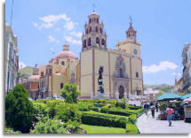 juato
Mummy Museum' still adds corpses to this day; two children were added who died
in 1984 most recently due to their relatives' failure to pay the $20 per 5-year
rental fee. The museum holds 111 corpses resting on velvet pillows. Today, it is
reported that the proceeds from the museum help fund the city's coffers to a
considerable degree. juato
Mummy Museum' still adds corpses to this day; two children were added who died
in 1984 most recently due to their relatives' failure to pay the $20 per 5-year
rental fee. The museum holds 111 corpses resting on velvet pillows. Today, it is
reported that the proceeds from the museum help fund the city's coffers to a
considerable degree.
The city of Guanajuato was the birthplace of artist Diego Rivera, whose house is
now a museum.
The city also harbours one of the largest places in Mexico for mathematical
research, a public institution dubbed CIMAT.
During the final week of July, Guanajuato and San Miguel de Allende are co-hosts
to the Expresión en Corto International Film Festival, Mexico’s largest
competitive film festival and the most prestigious of its kind in Latin America.
The internationally renowned festival is free to the public and screens over 400
films from 10am until 4am each day in 16 venues, which include such unusual
locations as the subterranean streets and tunnels of Guanajuato, the Guanajuato
Mummy Museum and Municipal graveyard (Panteónes).
Each October the city holds the Festival Internacional Cervantino, an
international festival of the arts named after Miguel de Cervantes. The festival
is a popular draw for young students from across central Mexico, but attracts
participants and spectators from around the world.
And the Festival Medieval Guanajuato is another important attraction.
Go to next Guanajuato Room
| |
|