Learn Spanish Learn Spanish Today Learn Spanish  Before You Go - Learn Spanish For Free


                                 HomeSpanishTrip PlanningMexico's RV ParksNevada RV & CampingPhotographsDestinations


Mexico Road Logs & Driving Guides - Click Here

Free Spanish Lessons

RV Insurance?

This is who we use (AND we might add, are very happy with their service) Get a Quote online? Click Here: MexPro Comparing US and Mexico Insurance

 
Mexico Photo's
 
Colonial Cities and Towns
 
Archeological Sites
 
If you travel to Mexico then you should check these publications out!

RV Parks

The Baja

The Pacific Coast

The Gulf Coast

The Interior

The Yucatan


Balam Kú Mayan Ruin Campeche Mexico Photography by Bill and Dot BellBalam Kú Mayan Ruin Campeche Mexico

Photography by bill and Dorothy Bell


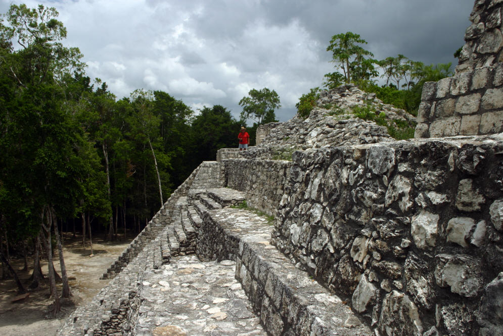
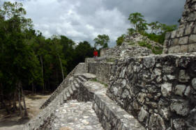
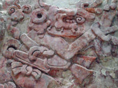
Near the village of Conhuas, in the Rio Bec area on Federal Highway 186 , a jungle track leads to an archaeological site with truly exceptional Mayan 
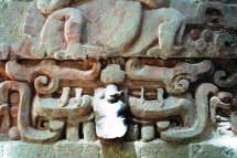
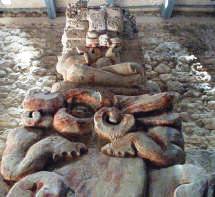
reliefs. Recently discovered (1990), the zone was  given a name meaning "Temple of the Jaguar", in reference to the felines characterizing the profuse decoration on the House of the Four Kings.

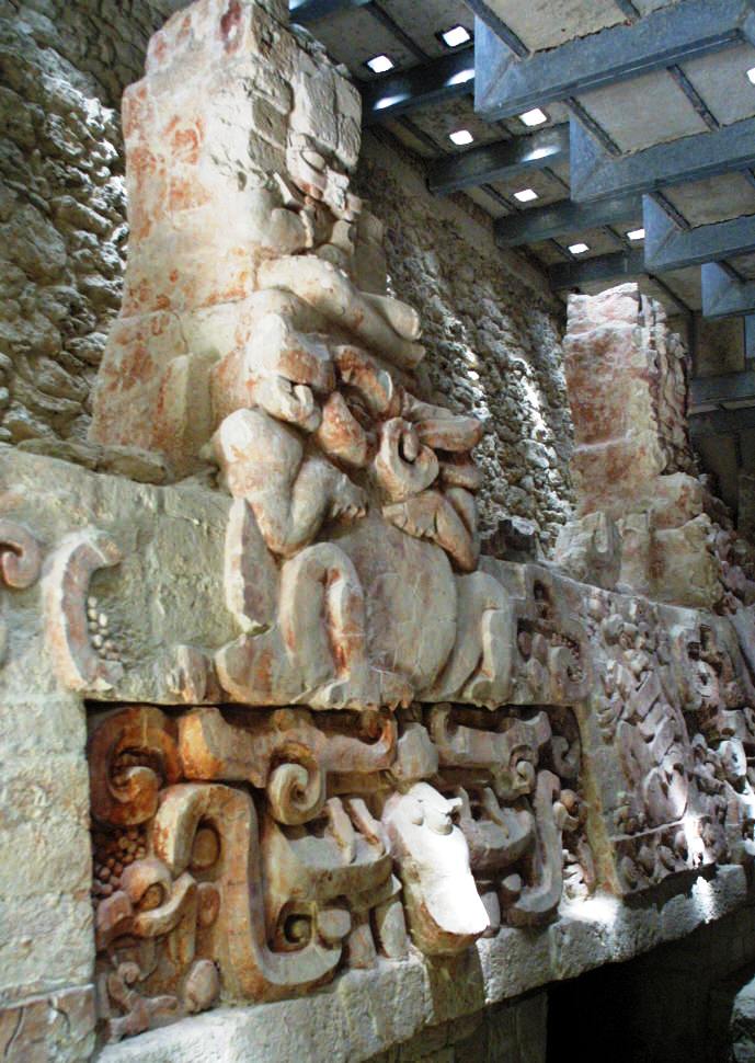
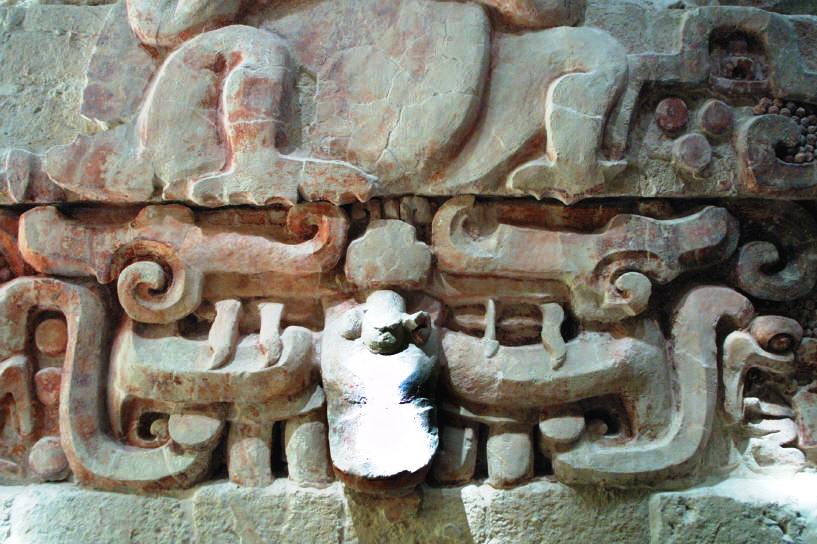
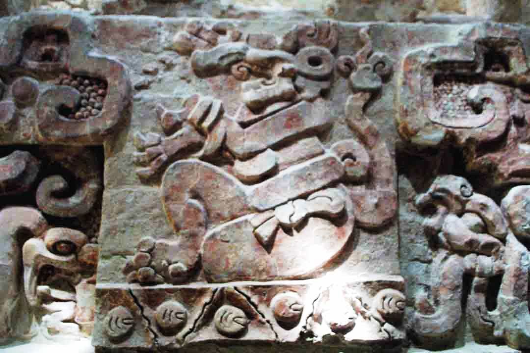
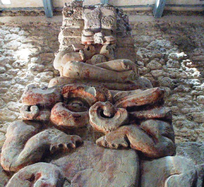
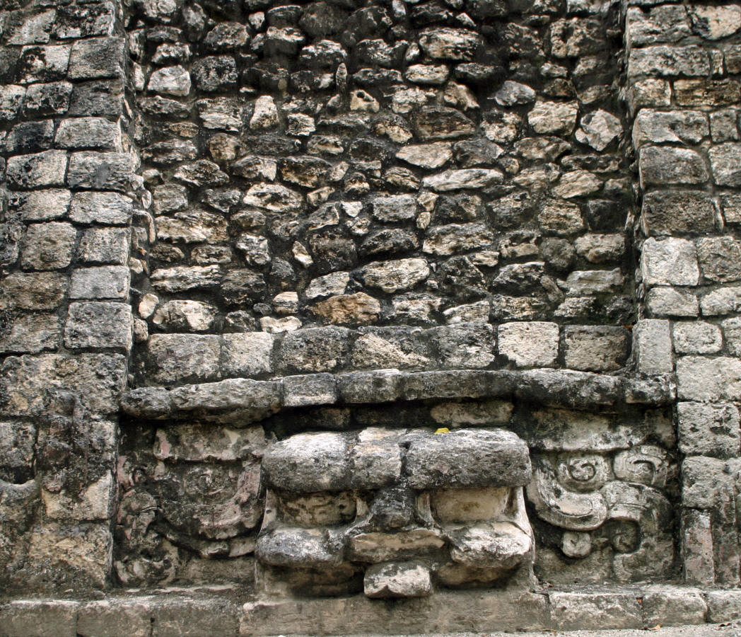
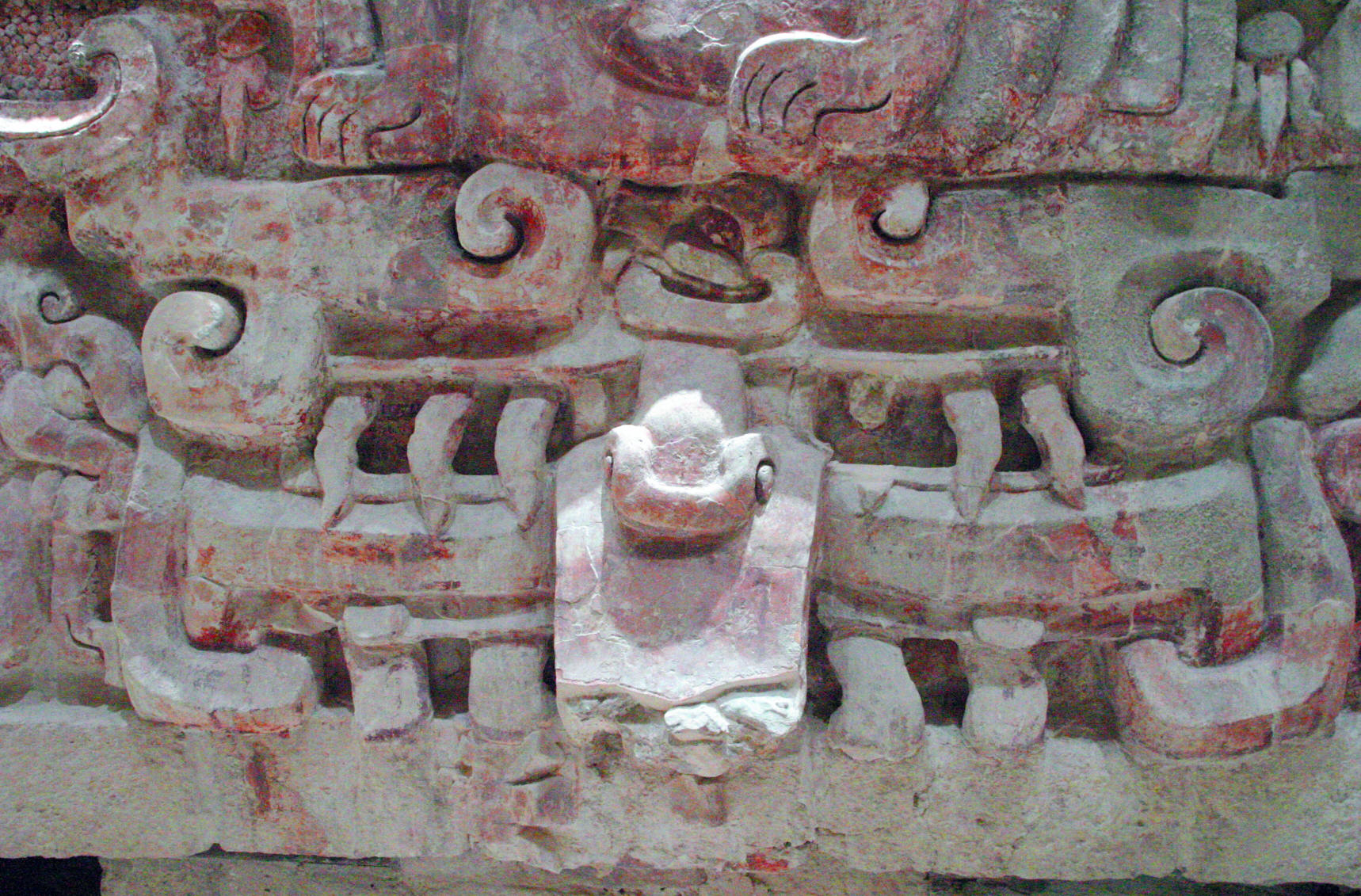
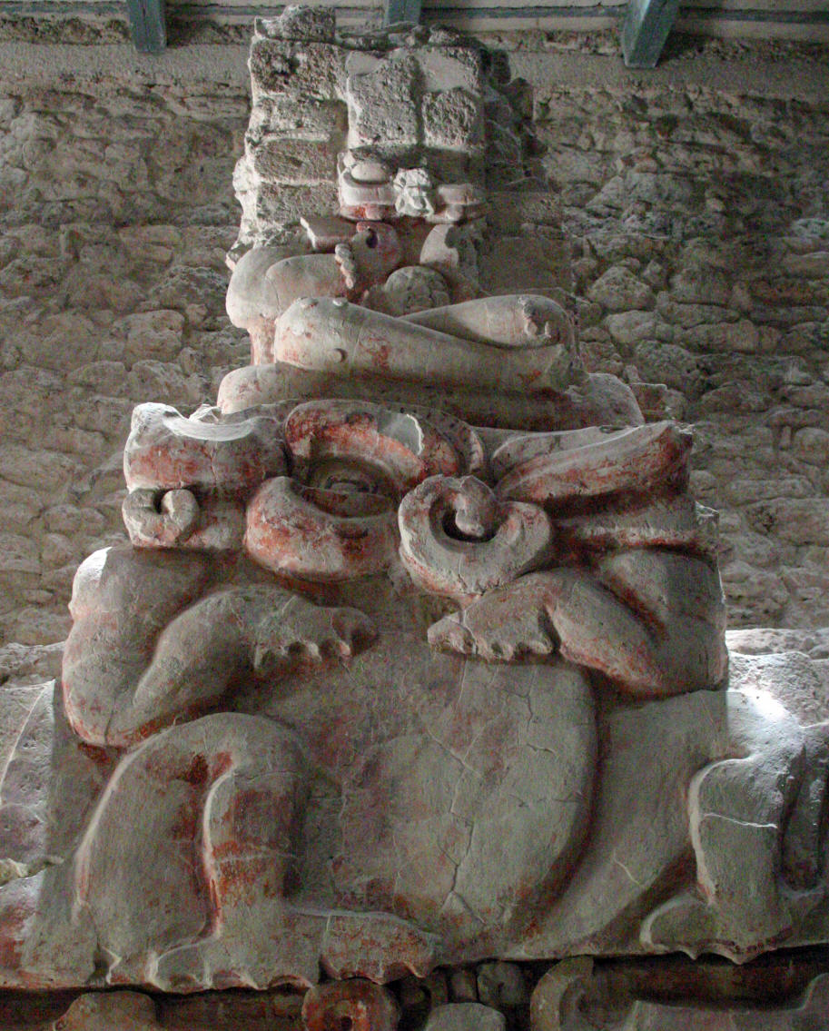
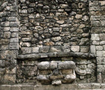
Aside from its jaguars, the large frieze is decorated with different  figures -the Kings-, who are shown sitting upon amphibious creatures resting upon masks. These red, painted stucco reliefs date from the early Classic period -250 to 600 AD-, and were covered by another pre-Hispanic building which may possibly have been built after the reliefs had lost their ritual significance for the local population.


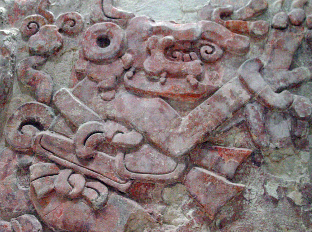
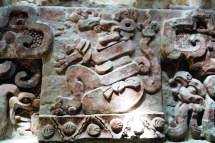
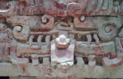
The frieze shows that the dynastic cycle is similar to its solar counterpart, with the King depicted as a representation of the Sun, and therefore fertility, emerging from the jaws of the monster of the Earth, just as the sun rises from the mouth of the Earth.


       Balam Kú Mayan Ruin Campeche Mexico Photography by Bill and Dot Bell

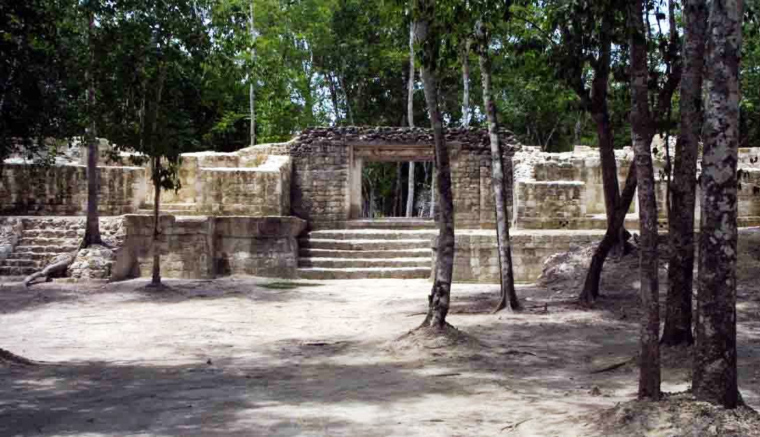
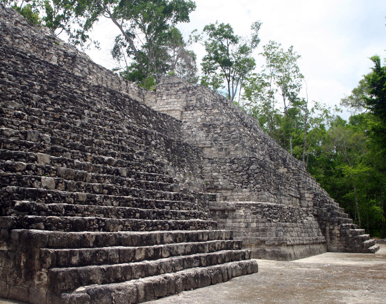
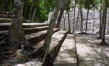
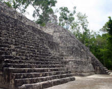
The house of the Four Kings is located to the north of a square surrounded by other constructions, one of which serves as an entrance to the site.


Balam Kú Mayan Ruin Campeche Mexico Photography by Bill and Dot Bell            Balam Kú Mayan Ruin Campeche Mexico Photography by Bill and Dot Bell     Balam Kú Mayan Ruin Campeche Mexico Photography by Bill and Dot Bell

       Balam Kú Mayan Ruin Campeche Mexico Photography by Bill and Dot Bell


Balam Kú Mayan Ruin Campeche Mexico Photography by Bill and Dot Bell  Balam Kú Mayan Ruin Campeche Mexico Photography by Bill and Dot Bell  Balam Kú Mayan Ruin Campeche Mexico Photography by Bill and Dot Bell

Balam Kú Mayan Ruin Campeche Mexico Photography by Bill and Dot Bell  Balam Kú Mayan Ruin Campeche Mexico Photography by Bill and Dot Bell  Balam Kú Mayan Ruin Campeche Mexico Photography by Bill and Dot Bell

GPS -     N 18*33.290  

                W 089*56.599


Other Rio Bec Mayan Sites Becan, Chicanna


Mexico Road Logs & Driving Guides - Click Here

Free Spanish Lessons


RV Insurance?

This is who we use (AND we might add, are very happy with their service) Get a Quote online? Click Here: MexPro Comparing US and Mexico Insurance.


Copyright Bell and Bell 2006. All rights are reserved. No part of this site, road logs or CD can be reproduced in any form without the express permission in writing of the authors.

For the problems or the questions with respect to this site contact dot@ontheroadin.com