Faces
of Mexico
Becán
by Bill and
Dorothy Bell
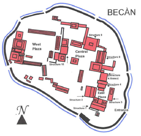
Becán is a one of the Major
Archeological site (of at least 45) that graces the base of the Yucatan
Peninsula. It is by and large, unknown by the core tourist crowd, and you can
walk by yourself in the forest as you discover restored pyramids, grand plazas
and temples and palaces.
 Becán
in the Mayan language means “Ravine formed by water,” and is named after the
moat that surrounds the ancient city. It can also be interpreted as “The Way of
the Serpent” ("Be" means camino or roadway; "Kan" means serpent) because of the moats waters that twist in
irregular size and shape. The fascinating moat, the only one as yet discovered
in the Mayan world, was used as a fortification around the limestone structured
City to head off potential problems with other trading and religious centers.
Clay works and figurines from Teotihuacán provide links to trade and possible
wars amongst Becán, Tikal and Teotihuacán.
Becán
in the Mayan language means “Ravine formed by water,” and is named after the
moat that surrounds the ancient city. It can also be interpreted as “The Way of
the Serpent” ("Be" means camino or roadway; "Kan" means serpent) because of the moats waters that twist in
irregular size and shape. The fascinating moat, the only one as yet discovered
in the Mayan world, was used as a fortification around the limestone structured
City to head off potential problems with other trading and religious centers.
Clay works and figurines from Teotihuacán provide links to trade and possible
wars amongst Becán, Tikal and Teotihuacán.
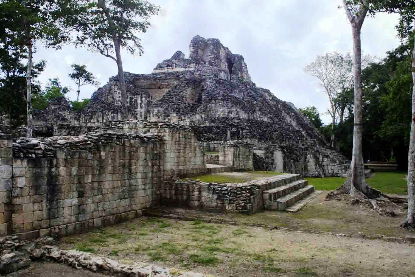
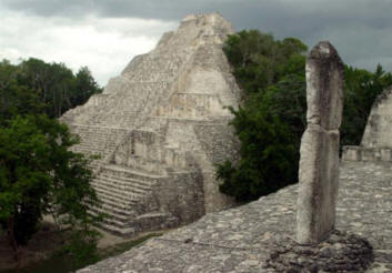
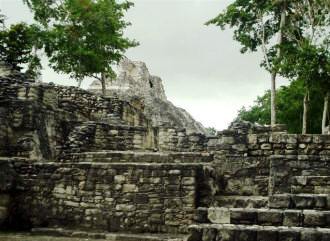
Twin
Towers of the Rio Bec region
 Becán
dates back to 600 BC and reached its peak between 600 and 1000 AD. It was a
major political and military center and is one of the many Cities that fought
against Tikal for dominance. It is located on Highway 186 between the present
cities of Campeche and Chetumal in the State of Campeche and is considered the
capital of the Rio Bec ancient cities. You can see the pyramids above the forest
canopy from a fair distance.
Becán
dates back to 600 BC and reached its peak between 600 and 1000 AD. It was a
major political and military center and is one of the many Cities that fought
against Tikal for dominance. It is located on Highway 186 between the present
cities of Campeche and Chetumal in the State of Campeche and is considered the
capital of the Rio Bec ancient cities. You can see the pyramids above the forest
canopy from a fair distance.
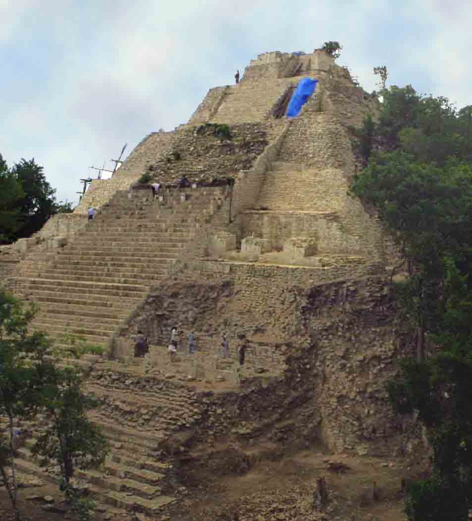
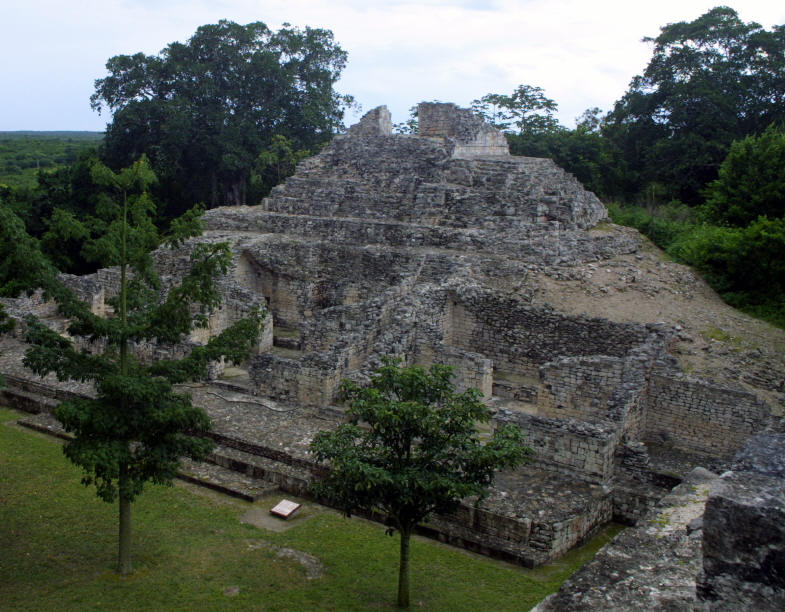
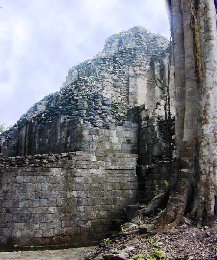
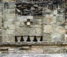
Detail and lattice work
The Rio Bec style includes large platforms, two –
sometimes three towers grace the large pyramids with a grass or palapa roof on
the top. Often there are false stairways and misleading entrances. The City is
characterized by large plazas surrounded by monumental structures indicating its
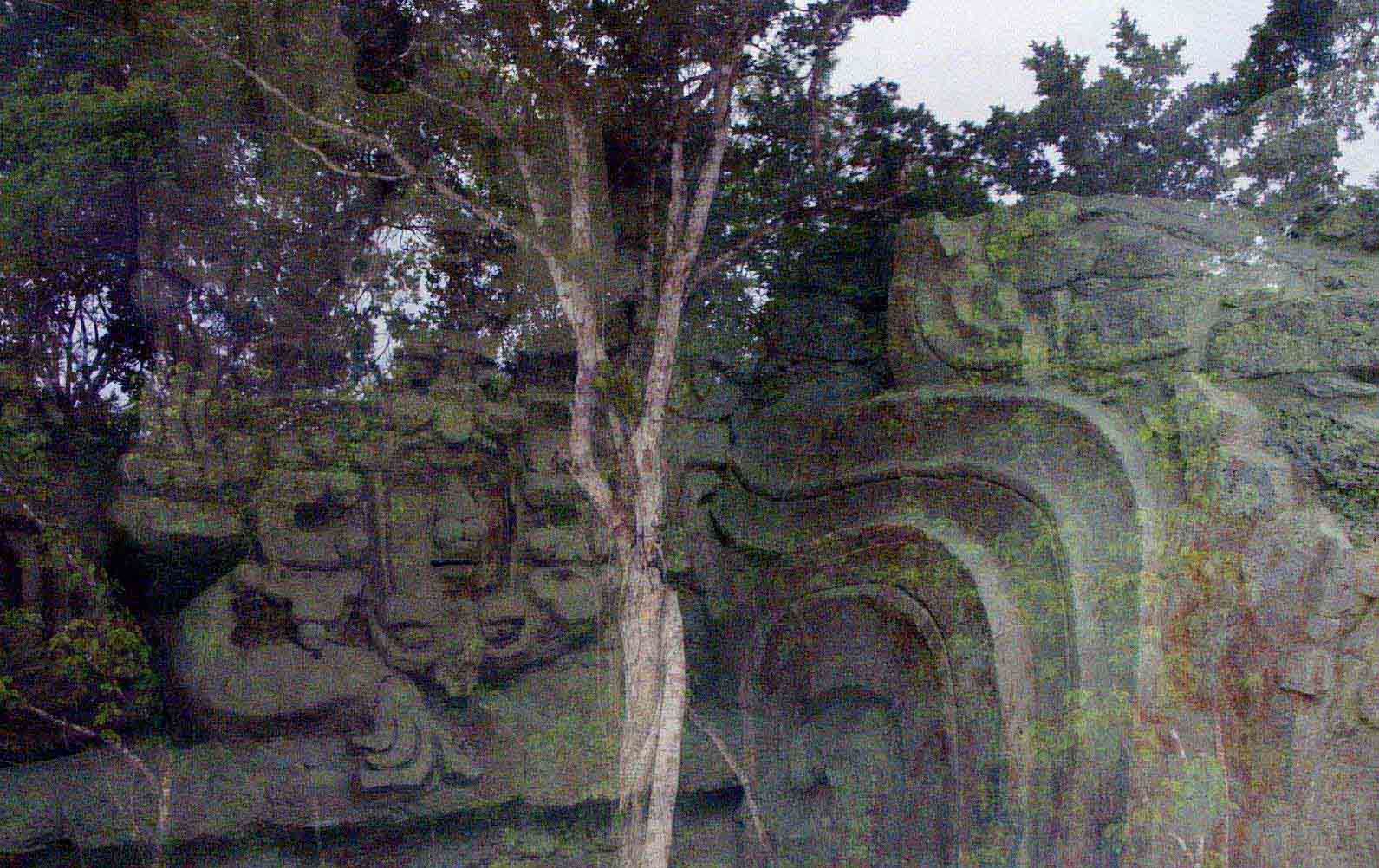
importance in the region. Becán also shows signs of the Chenes influence with
detailed masks of the Itzamna god, also called the Earth Monster. The highest
structure is approximately 30 meters or100 feet high.
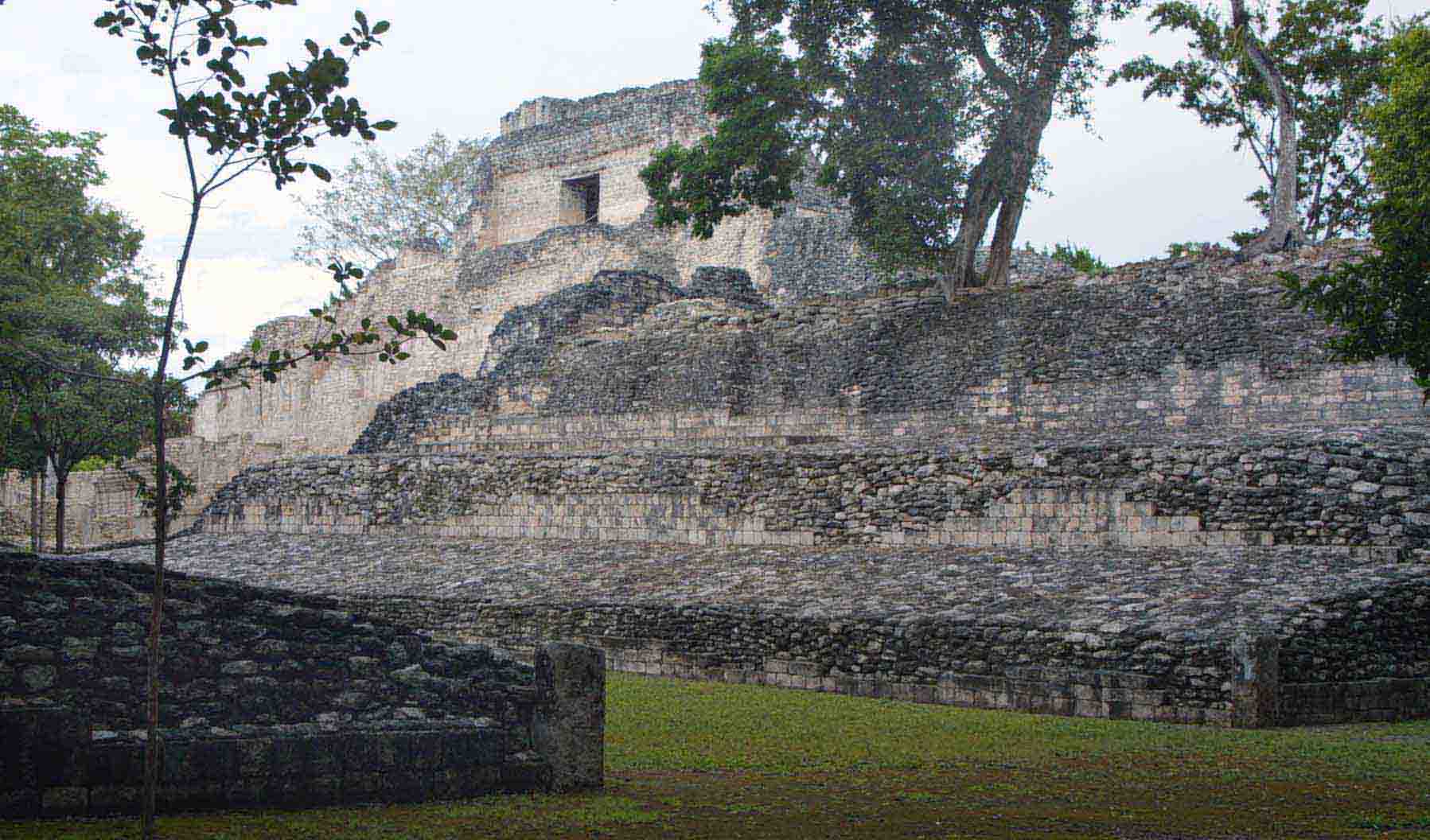
The now dry moat twists nearly 2000 meters around the
city core; sometimes reaching a width of 16 meters and a depth of 7 meters. The
earth and limestone used to construct the walls were excavated from this
man-made waterway making it difficult for invaders to scale the heights
unnoticed. It has seven bridges or gateways that lead to the 63+ acre city for
both people and supplies. They lead to a sacbé system of roads in the region.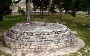
Inside the city is a maze of dirt roads leading from
one complex to another. Like many ancient cities, Becan has a small but well
defined ball court. An unusual feature situated prominently in the main plaza is
a round pyramid dedicated to the God of Wind.
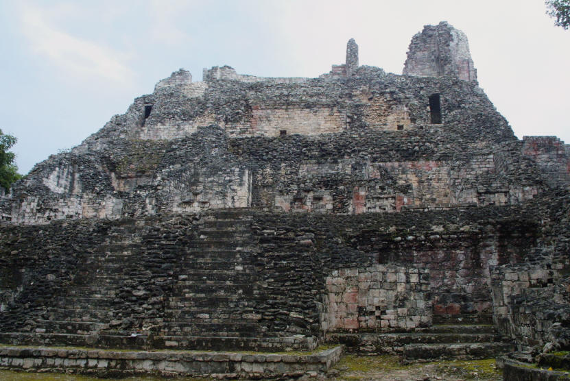
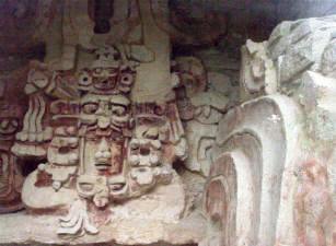
Dedicated to the Wind God
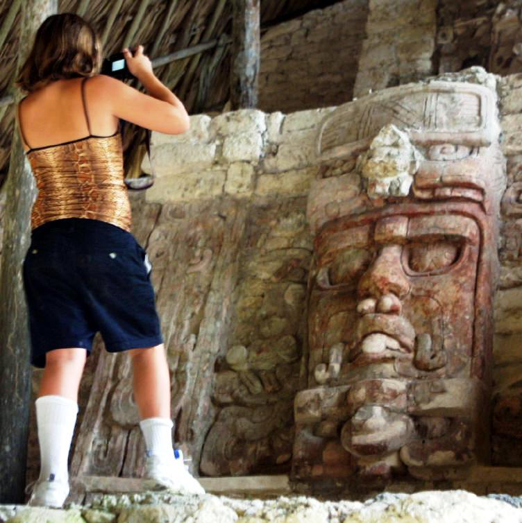
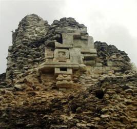
The best example of the “Monster” is on Temple X – whose mouth is the
entrance doorway. A remarkable mask of the Sun God Kinichna is protected in a
climate controlled room flanking that same pyramid. It is well preserved with
very defined features and with its original paint.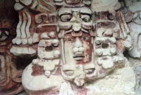
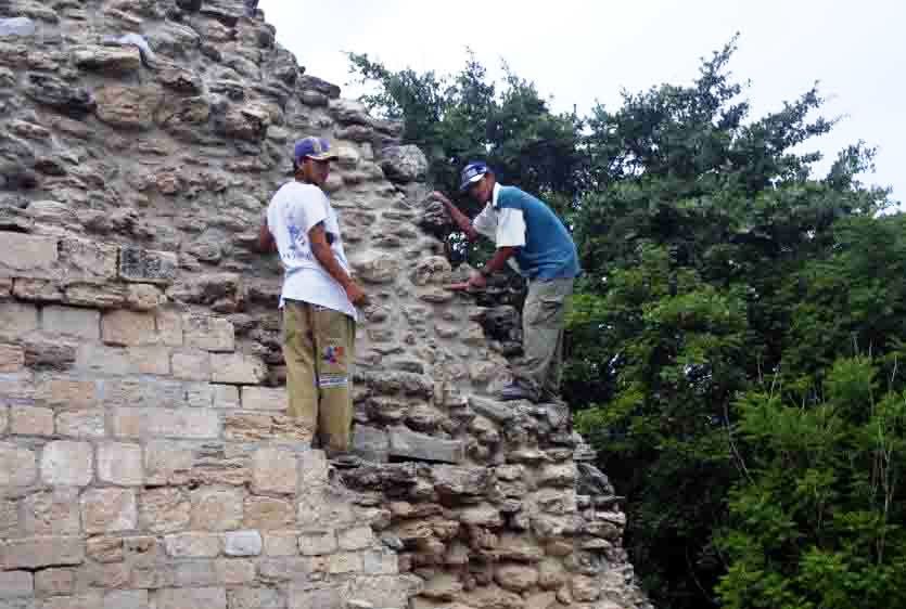
You can stroll safely undisturbed throughout the site.
Take good shoes as there is plenty of climbing- and a fair amount of film or
memory and batteries for your photographs. The site is open seven days a week
from 8am to 5 pm. There
is a watchman at the gate who will charge you the standard fee – currently
approximately $4 – extra for video cameras
Sun
God Kinichna