 Patzcuaro, Michoacán


“Pátzcuaro is a very special place. Our daughter Justine Bell was married here to Michoacán native Guillermo Trejo. The lovely colonial setting was perfect for their special day.
Pátzcuaro has worked hard retaining its indigenous colonial look. Building retain their old world charm and somehow that context seeps into the souls that inhabit the city. The marketplace is authentic. The squares are delightful.
Pátzcuaro is a favorite for many people. Tourists come here to find the heart of Mexican soul.”
Dorothy Bell

Name: Pátzcuaro has a number of possible origins possible from
- petatzimícuaro meaning place of bulrushes
- patatzecuaro, which means place of foundations
- phascuaro” which means place dyed in black
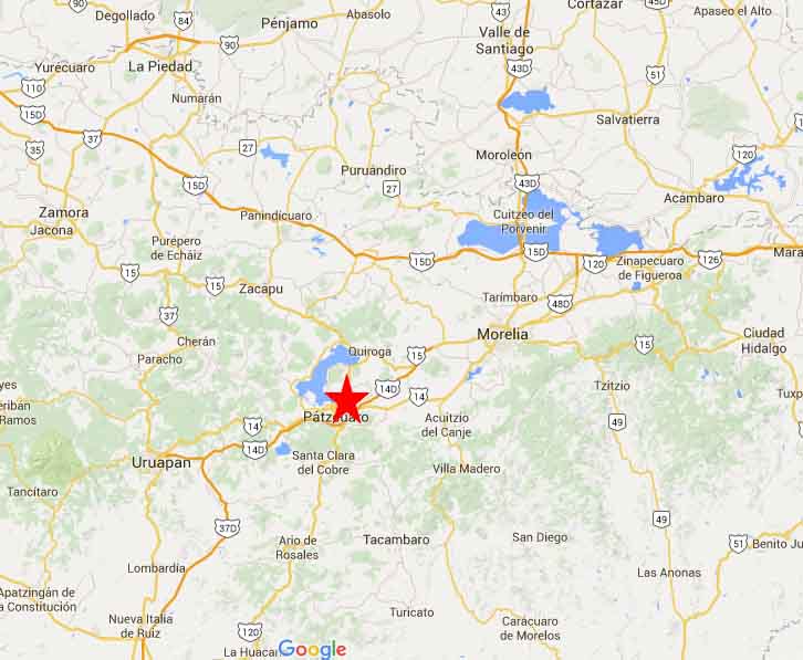
Location: Pátzcuaro is located in the State of Michoacan in the Center west of the country. It is in a basin with mountains nearby (Cerro el Blanco, Cerro del Estribo, Cerro del Frijol and Cerro del Burro) and sits on the trans Mexican Volcanic Belt.

Weather: Temperate with rain in the summer.
January Average Highs 25 Lows 6
July Average Highs 27 Lows 14
Population: 80,000 Municipality
Elevation: 2,140 m (7,020 ft)
Founded: In 1324 by 2 indigenous tribes which was later abandoned. In 1538, the Spanish established a settlement here.
Medical: Hospital, doctors, dentists
Money: Banks and ATMs
History:
Today:
Getting there:
From Uruapan drive East. Morelia drive west on Highway 140D
Accommodation
HOTELS

RV Parks nearby
Patzquaro
Uruapan


Pátzcuaro is a very special place. Our daughter Justine Bell was married here to Michoacan native Guierrmo Trejo. The lovely colonial setting was erfect for their special day.
Pátzcuaro has worked hard retaining its indigenous colonial look. Building retain their old world charm and somehow that contex seeps into the souls that inabit the city. The marketplace is authentic. The squares are delightful.
Pátzcuaro is a favorite for many people. Tourists come here to find the heart of Mexican soul.


Name: Pátzcuaro has a number of possible origins possible from
petatzimícuaro meaning place of bulrushes
patatzecuaro, which means place of foundations
phascuaro” which means place dyed in black
Location: Pátzcuaro is located in the State of Michoacan in the Center west of the country. It is in a basin with mountains nearby (Cerro el Blanco, Cerro del Estribo, Cerro del Frijol and Cerro del Burro) and sits on the trans Mexican Volcanic Belt.
Weather: Temperate with rain in the summer.
January Average Highs 25 Lows 6
July Average Highs 27 Lows 14
Population: 80,000 Municipality
Elevation: 2,140 m (7,020 ft)
Founded: In 1324 by 2 indigenous tribes which was later abandoned. In 1538, the Spanish established a settlement here.
Medical: Hospital, doctors, dentists
Money: Banks and ATMs
History:
Today:

Getting there:
From Uruapan drive East. Morelia drive west on Highway 140D
Drive from.
Accommodation
RV Parks nearby
Patzquaro
Uruapan


