|

| |
Tequisquiapan Mexico Photography
Photography by Bill Bell
Tequisquiapan is a city in the south-central part of the Mexi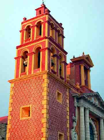 can
state of Querétaro. It is famous for its thermal waters, and for being the
center of a wine and cheese producing region. The city serves as municipal seat
of its surrounding municipality of the same name. At the 2005 census the city
showed a population of 26,858 inhabitants, the fourth-largest community in the
state in population, while the municipality had a population of 54,929. The
municipality has an areal extent of 343.6 km² (132.66 sq mi) and includes
numerous smaller communities, the largest of which are San Nicolás and La
Fuente. can
state of Querétaro. It is famous for its thermal waters, and for being the
center of a wine and cheese producing region. The city serves as municipal seat
of its surrounding municipality of the same name. At the 2005 census the city
showed a population of 26,858 inhabitants, the fourth-largest community in the
state in population, while the municipality had a population of 54,929. The
municipality has an areal extent of 343.6 km² (132.66 sq mi) and includes
numerous smaller communities, the largest of which are San Nicolás and La
Fuente.
Tequisquiapan, famous for its spas with thermal waters, becoming a popular
tourist resort for Mexico City and Querétaro residents, as well as a place to
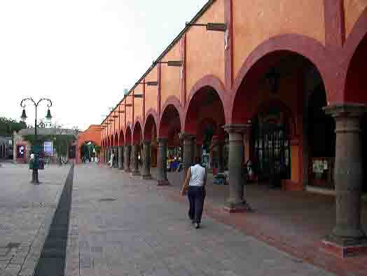
vacation for many Europeans. Its mild climate and winding colonial streets make
it ideal for leisurely strolls. In the center of the town stands Plaza Miguel
Hidalgo, dominated by a 19th-century wrought-iron pavilion and surrounded by
stone archways. At one end stands the parish church of Santa María de la
Asunción, with its neo-classic facade, completed in the mid-19th century.
Spanish missionaries said the town's first mass under the giant mesquite tree
next to it.
A mosaic of small, irregular, interlocking stone blocks pave Tequisquiapan's
narrow streets, which lead to the central square, the Plaza Civica. Traffic is
closed a block or two from it creating a pedestrian zone. Scattered throughout
the town are several hotels with their own springs. Just a few yards from the
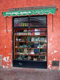
numerous shops surrounding the Plaza de Tequisquiapan lies the market where
visitors can admire and purchase locally-crafted rush and wickerwork.
At the gateway to the Sierra Gorda, rising up is the peak of San Bernal, a
gigantic 350 meter high monolith, the third highest in the world after the Rock
of Gibraltar and Río de Janeiro's Sugarloaf Mountain. This rock is said to bring
the inhabitants on the town a long life; the average life span of Bernal
residents is said to be a staggering 94.7 years.
History
Plaza Miguel Hidalgo with the parish of Santa Maria de La Asunción in
 the
back.Before the arrival of the Spanish conquistadors, the area now occupied by
what's now the town of Tequisquiapan was commonly known as "Tequesquiatlapan,"
meaning "River with carbontated water." Today, Tequisquiapan is a tourist town a
weekend retreat for hundreds of Mexico City residents who come for its crystal
clear air and sparkling thermal waters. the
back.Before the arrival of the Spanish conquistadors, the area now occupied by
what's now the town of Tequisquiapan was commonly known as "Tequesquiatlapan,"
meaning "River with carbontated water." Today, Tequisquiapan is a tourist town a
weekend retreat for hundreds of Mexico City residents who come for its crystal
clear air and sparkling thermal waters.
During much of the Pre-Hispanic period, the valley of Tequisquiapan was more
than just a village. The great Nahua and Chichimeca chieftains acknowledged the
importance of the place.
According to local chronicler Jesús Landaverde Chávez, the lords of Jilotepec
frequented the natural springs and fountains of Tequisquiapan only during very
special occasions. Upon arriving , they would take a bath in the thermal waters
of one of its numerous springs, during which they would deal with affairs of
state and settle mild disputes among themselves.
The first Spanish settlements in this valley date from the 16th century, when
Don Luis de Velazco, then Viceroy of New Spain, conceded Alonso de Estrada y
Lope de Sosa the rights over the valley to breed livestock and keep stables. In
the process of building Hacienda de Tequisquiapan in 1596, he displaced the
former residents of the site to the other side of the river.
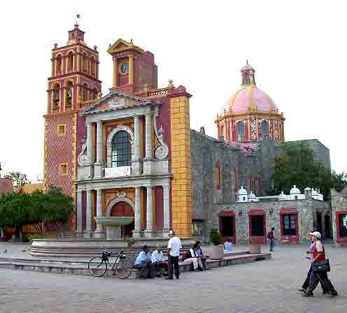
The town square is anchored by this church and fountain.
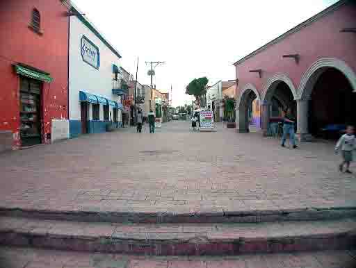
The streets are pedestrian friendly
Go to the next Tequisquiapan Room
| |
|