|
Home
Regions
Planning & Info
RVing Archeology
Articles
Road Logs Insurance Photos Mexico News Ontheroadin |
|
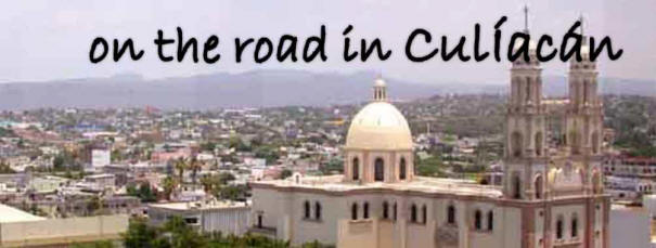
Culiacán, Sinaloa
"Palace of Snakes" Or “Those who adore the crooked God Coltzin”
Culiacán is the capital and largest city in the State of Sinaloa and sits inland in the middle of the state. It is a the center of the agriculture business on the west coast of Mexico and one of the most important bread boxes for the country. Culiacán is the birthplace of the Sinaloa Cartel and the economy has been fueled by the underground economy through illegal drug activities.
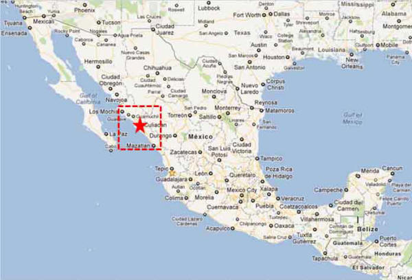
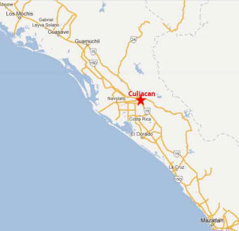
Culiacán Fast Facts Location – Culiacán is located in the center on the state of Sinaloa – in the Pacific North western side of the country. It sits in the valley where the Tamazula and Humaya rivers meet to form the Culiacán River
Weather – Semi arid Climate. Summers are hot and humid. Winters are mild. January average Highs 27.5C (81.5F) Lows 10.6C (51.1F) July average Highs 42.5C (108.5F) Lows 35.4C (95.7F) Rainiest Months are July (145.3 mm (5.72 inches) August 191.6 mm (7.543 inches) and September 129.3 mm (5.091 inches) Population – 860,000 Elevation – 55 M Founded – 1531 Medical – Hospitals, Clinics, Doctors, Dentists, Specialists. Money – Numerous Banks, ATMs Airport - Bachigualato International Airport or the International Airport Culiacán Federal. Domestic, International, Military. It is the eleventh most important airport of the country by number of passengers Industry – Culiacán produces 32% of Sinaloa’s economy through mainly agriculture. History: Since 628 the location was home to small Indian groups. In 1531 Nuño Beltrán de Guzmán founded the city and named it San Miguel de Culiacán. It was also instrumental to numerous other expeditions including Francisco Vásquez de Coronado who started his journey here to settle the south western states in the US. The state and this area attracted European migrants and it remained a peaceful pleasant town. When the dams were built in the mid 1900’s, agriculture boomed and Culiacán experienced rapid growth. Agriculture remains the areas main industry. In the late 1950s, Culiacán developed an underground economy based on drugs. The gangs have grown and Culiacán has maintained the dubious reputation as the birthplace to the Sinaloa Cartel. The original families remain head of the existing cartel. Festivals Things to See and Do: Walk Centro - Start on Calle Rosales and visit the plaza and Cathedral Regional History Museum in the "Parque Constitución” Botanical Garden Centro de Ciencias de Sinaloa – an interesting science museum that has on display the 5th largest meteorite in the world. Parks
Ernesto Millán Escalante Park - pools,
attractions, an artificial lake, gardens, sports courts, the
long water slide, an open air theatre Shopping Culiacán is known for its large and modern shopping centers Accommodation: Hotels RV Parks Culiacán
Celestino
Culiacán is easily accessible from Mexico Highway 15 south of Los Mochis and North of Mazatlan
|
Back to Mexico's West Coast Cities, Towns, Pueblos
*
|
|
What You Should Consider for Your Visit
|
|
 Directions:


On the Road In - Mexico
editor@ontheroadin.com