|
Home
Regions
Planning & Info
RVing Archeology
Articles
Road Logs Insurance Photos Mexico News Ontheroadin |
|
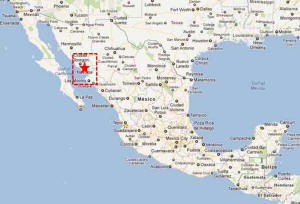
"Cactus House" Navojoa doesn't impress as you drive through town on Highway 15. For the average tourist it is a supply town on the way to the beaches on the coast, a journey to Alamos or travels further south. However it is worth the time to take a moment and discover some of the museums and peoples of the area. Navojoa Fast Facts Location – Located in the southern part of the state of Sonora in the Mayo Valley. Population – 150,000 Weather – Navojoa enjoys hot summers and cool winters. January average High of 23C (74F) and low of 5C (41F) July average high 35C (95F) average lows 21C (70F) Elevation – 50 M (160 ft) Founded – Diego de Guzman in 1536 was the first European in the valley. Jesuit missionaries followed in the early 1600’s. Established in 1907 as a City Industry - Agriculture Money – Abundance of banks and ATMs Airport – Navojoa has a small airport used for light commercial and private planes as well is used as a racetrack. Ciudad Obregón International Airport is the nearest commercial airport. Medical – Doctors, dentists, hospitals History: The Mayo Valley was inhabited by the Mayo Indians for centuries before the arrival of the Europeans in the mid 1500’s and the Jesuits some 50 years later. It has always been prime farm land. Navojoa and the area was far from the center of the conflict during the 1800’s battle for independence from Spain and enjoyed a relatively peaceful existence. In February 1880 Álvaro Obregón Salido was born in Hacienda Siquisiva a town just outside of Navojoa. Obregon became an successful chick pea farmer and then was elected president of Hautabampo. He became involved in the Mexican Revolution of 1910 and was recognized for his superior military instincts. He led many battles and recruited troops from the Sonora and Sinaloa region. He became President of Mexico (19 February 1880 – 17 July 1928) and brought prominence to the area. He was known to start the agricultural revolution – brining new ideas and technology to the Mayo Valley area. Festivals: San Juan June 24 – Colorful Mayo Indian Festival Things to see: Museo Regional del Mayo located in the former railway station, the museum celebrates the mayo culture with permanent and temporary exhibits including handicrafts, sculpture, pre-Hispanic and colonial art. The Tehuelibampo Museum located next to the Mayo River north west of the city displays 89 petro glyphs carved in stone. Beaches: Beaches – Head west to the sea of Cortez. Particularly popular with the locals is a small beach community called La Bocas - 40 KMs away. The Adolfo Ruiz Cortinez Dam supplies irrigation water for the valley but also offers a number of recreational opportunities including fishing, kayaking and water-skiing. Navojoa is also the jumping point to visit the colonial Silver City of Alamos. Accommodation: Hotels RV Possibilities:
Navojoa Navajoa Trailer Park - Reported Closed
Àlamos
Huatabampito
Driving to Navojoa: Highway 15 runs through the center of the city. It is north of Los Mochis and south of CD Obregón.
|
Back to Mexico's West Coast Cities, Towns, Pueblos
*
|
|
What You Should Consider for Your Visit
|
|
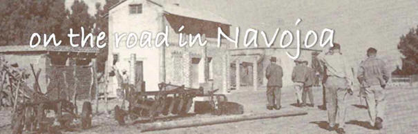
 Navojoa, Sonora
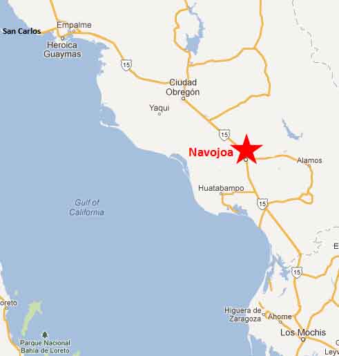


On the Road In - Mexico
editor@ontheroadin.com