MEXICO ON THE ROAD IN
Home
○Regions
○
Planning & Info ○
RVing ○
Road Logs ○ Insurance
○ Photos
○
Mexico News ○
Ontheroadin
![]()
|
MEXICO ON THE ROAD IN
Home
○Regions
○
Planning & Info ○
RVing ○
Road Logs ○ Insurance
○ Photos
○
Mexico News ○
Ontheroadin
|
|
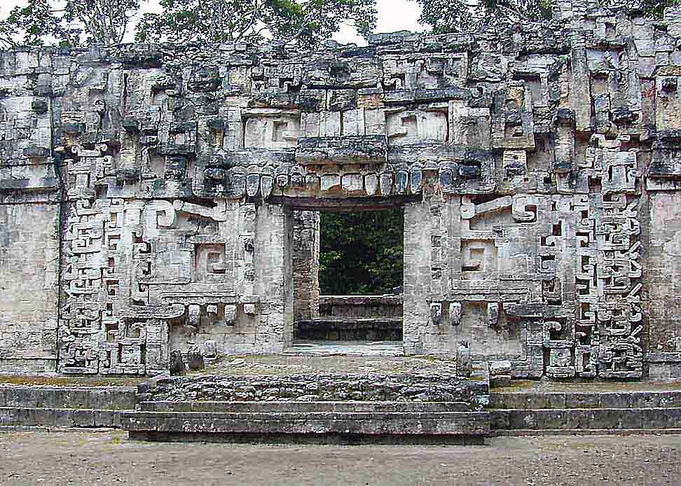
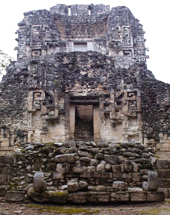
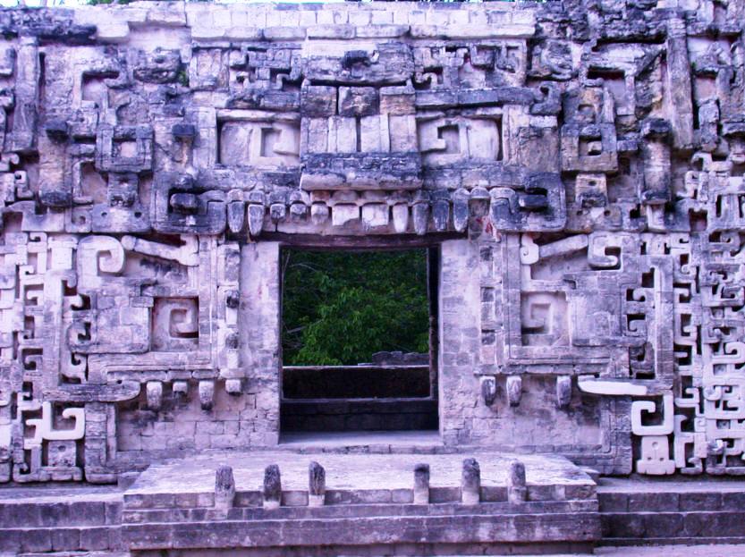
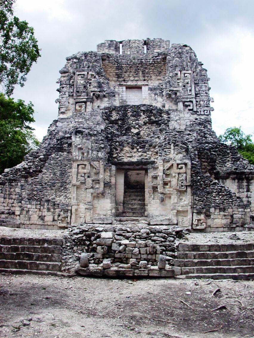
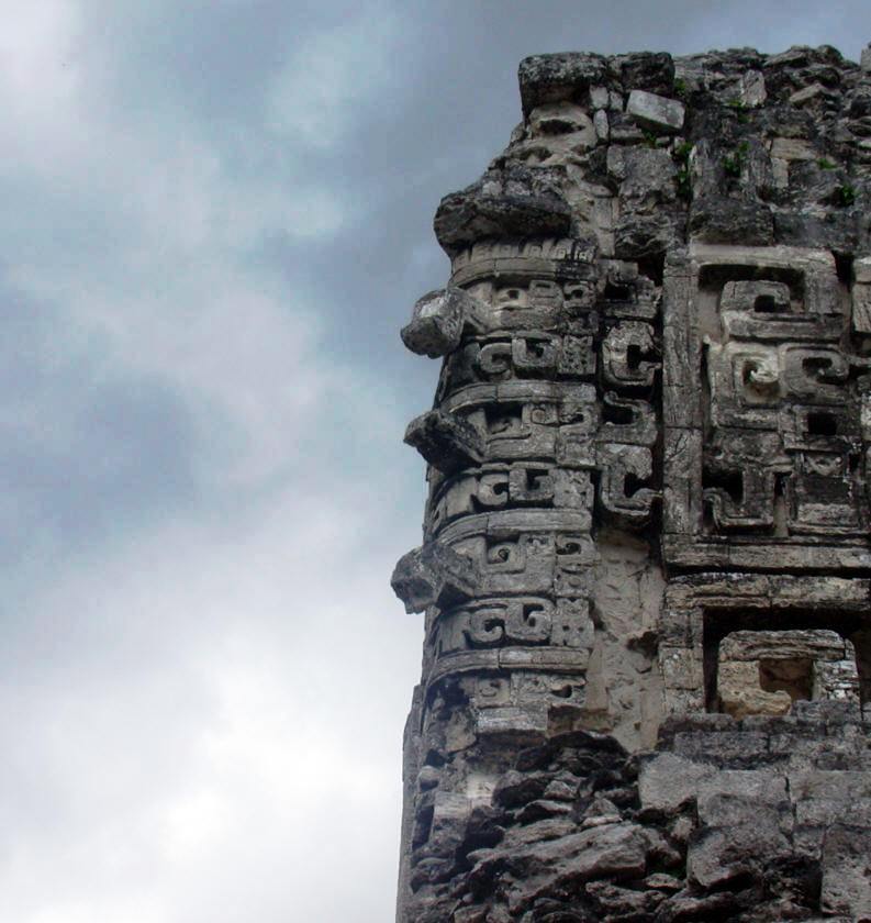
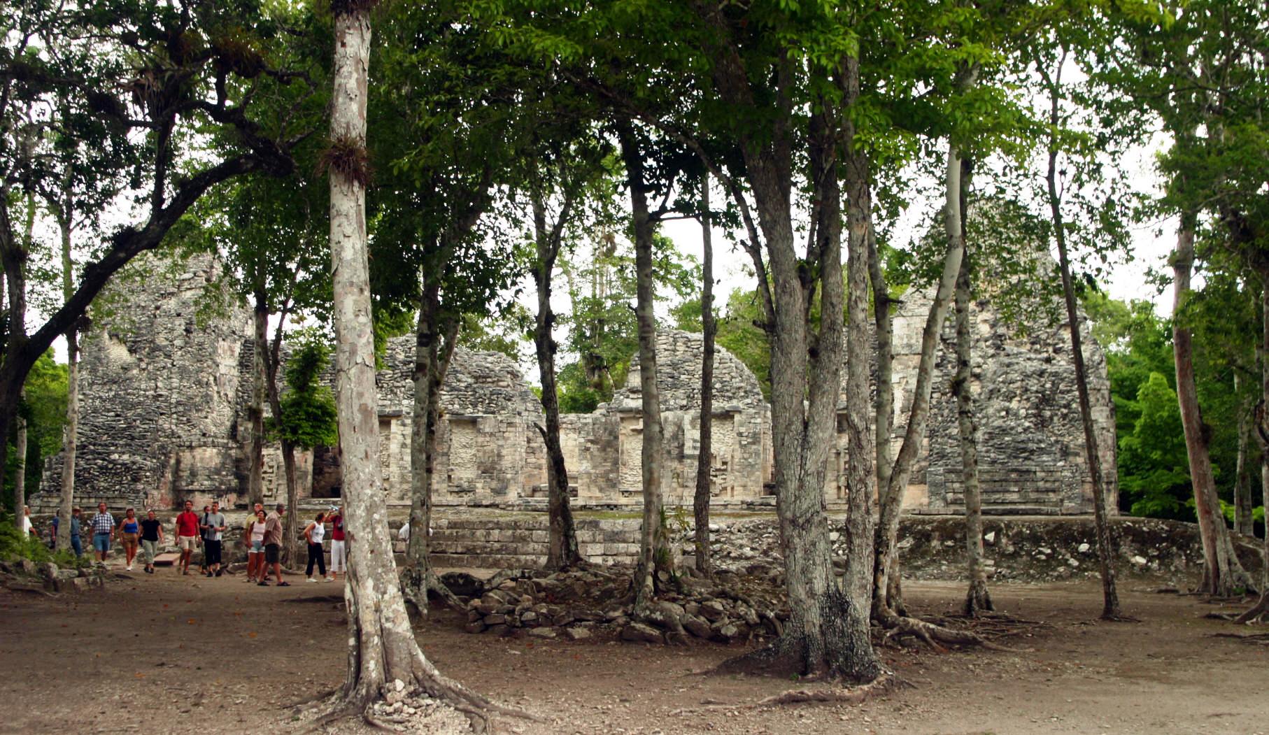
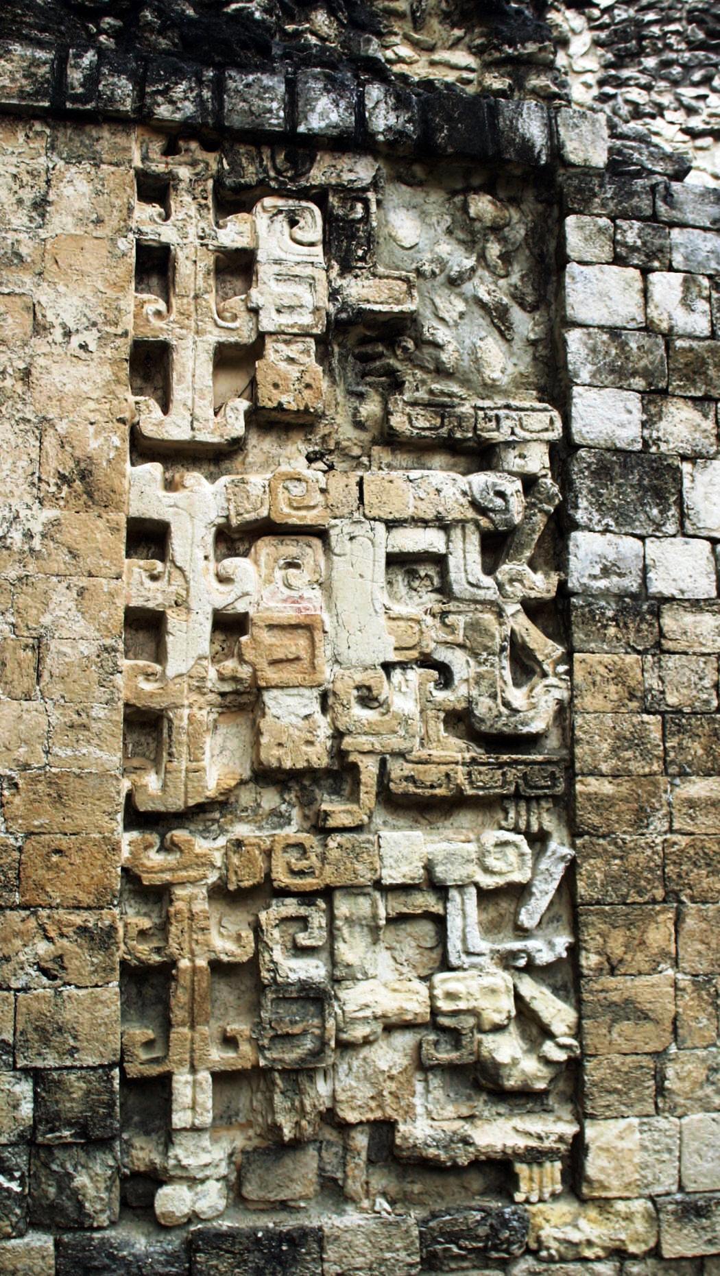
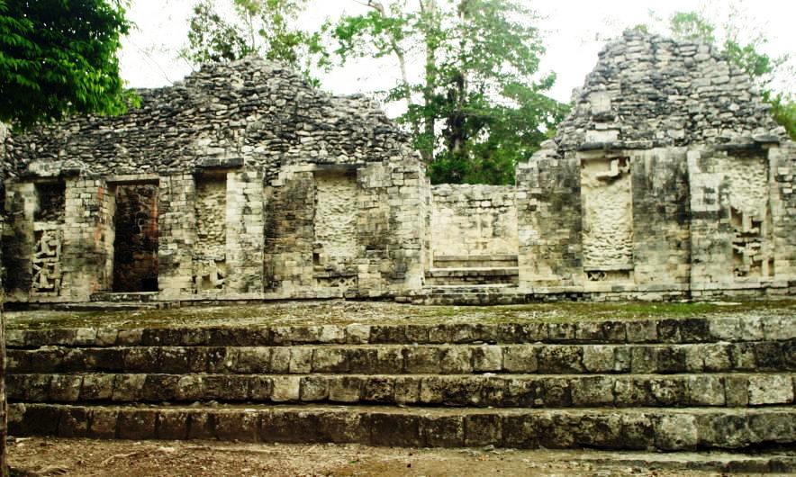
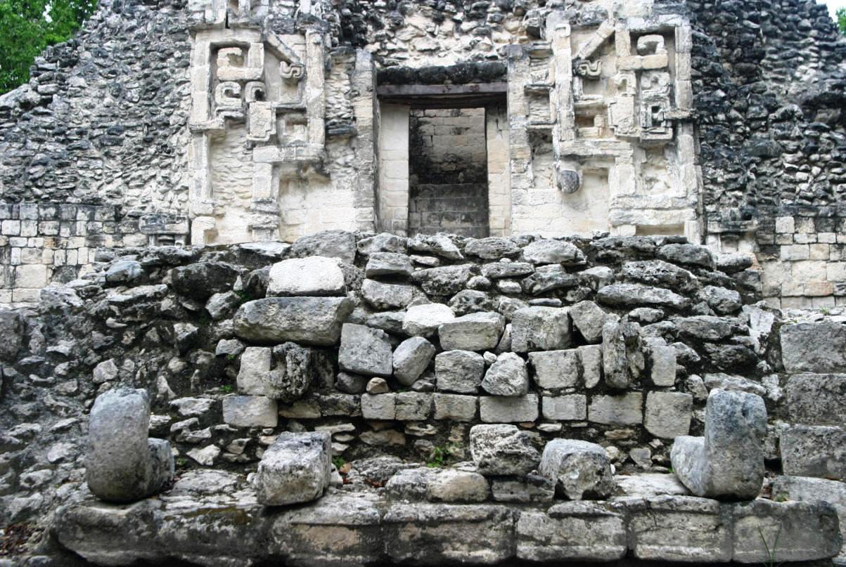
Chicanna Campeche Mexico Mayan RuinsPhotography by Bill Bell Chicanna was erected at the base of the Yucatan Peninsula. Its builders took advantage of a slight natural elevation to construct several groups of structures which served as rooms and enclosures for carrying out ritual ceremonies. Discovered in 1966, the name alludes to the House of the Serpent-mouth. Occupation at it height dates from 300 B.C. to 250 A.D. with the last stages likely around 1100 A.D. Chicanna is one of 45 sites located in the region of the Rio Bec. It is well known for its enormous representation of Itzamna, principal god of the Maya pantheon, also known as the Earth Monster, on the façade of the lower construction.
The earth monster entrance , notice the mouth and teeth (click on pictures to view in larger format)
Chac-Mool, the Mayan God of Rain
Another view of the earth monster
Other Rio Bec Mayan Sites to visit: Balam Ku, Becan GPS - N 18*00.545 W 0899*29.077
To view photography of other ancient Mexican Sites click here |
|
Copyright Bell and Bell 2006 to 2009. All rights are reserved. No part of this site, road logs or CD can be reproduced in any form without the express permission in writing of the authors. For the problems or the questions with respect to this site contact dot@ontheroadin.com
|